Black Forest Section 16
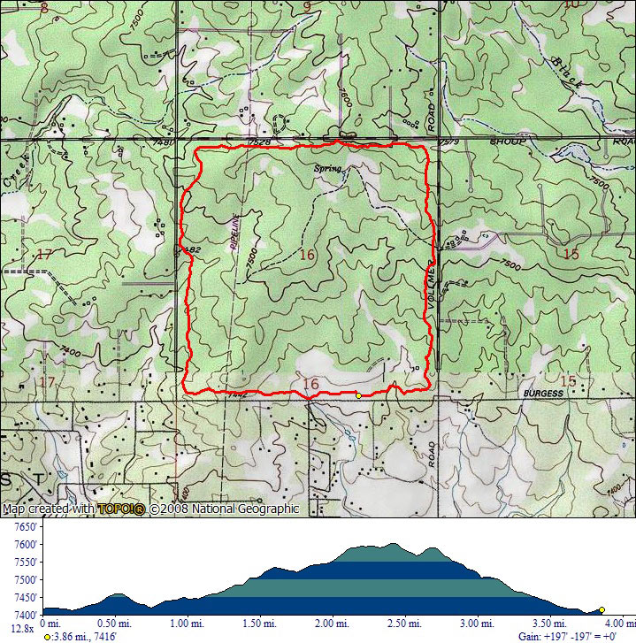
Black Forest Section 16 is a rectangle-shaped loop in the Black Forest, north of Colorado Springs. The trail is a fairly wide gravel path with very little elevation change.
The area is heavily forested, providing some shade during your hike. It is open to non-motorized use and it's popular with horse riders.
Distance: 4 mile loop
Hours: Dawn to Dusk
Difficulty Rating:
Directions: Drive east on Woodman road. Turn left on Black Forest Road and then immediately right on Vollmer Road. Drive for 4.5 miles and then turn left on Burgess Road. The parking lot will be on your right.
Map
Gallery


Comments: Have you hiked this trail? Please leave your review / comments / updates or photos.
Additional Resources
- GPX File
Universal GPS Format - KMZ File
For Google Earth - Full Screen Map
Trail Map and Photos - Topo Map
Topographic Map - Google Photos
External Image Gallery - Directions
Directions to the trailhead - Geocaches
Nearby Geocaches